Magical spaces, nature in its purest state, historical and artistic heritage, culture, water, stone, …. Open your eyes wide and soak up the sensations and emotions that each and every one of the experiences that this destination offers you.
Visit it, get to know it, enjoy it. It will not leave you indifferent!
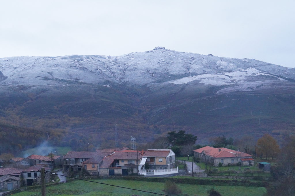
If any municipality can be interpreted by the traveller as a mountain municipality, it is undoubtedly that of Verea, since there are many sceneries that frequently exceed one thousand metres in length and width, while, unlike the rest of the municipalities in the region, their lowest elevations hardly fall below seven hundred metres.
And it is precisely in its mountains where tourist interest reaches its true potential. One only has to place oneself in the loud and high “Outeiro de aguas” (which the writer defends as “Outeiro de eguas”) and start walking towards the “marco 21” to realize that “here winter has its home”, asking us in silence why these hills would not also embrace the boundaries of the Xurés Natural Park.
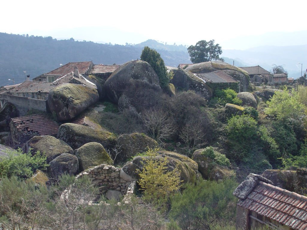
“Outeiro de Eguas”, “As catro Cruces”, “A Portela do Pau”… Everything is growing step by step until reaching the great dolmen landmark of southern Galicia: La Mota Grande. A spectacle that only some of us had the privilege of exploring inside, because now it is covered and waiting – perhaps impossible – for a great plan that will bring it to light as it deserves and turn the altiplano – with its more than 100 burial mounds – into a tourist resource of international dimension.
But Verea is more than just Mota Grande and the Serra do Leboreiro. It is a river. It is bread. It is literature in Cexo and in Orille, popular art. It could even be an example of industrial tourism if one day the good time comes for the only hydraulic sawmill that preserves this district.
The traveller will not know the name of Ramiras. However, he will have to go a little further into this municipality to realise that, orographically, Ramirás is synonymous with the valley. A valley of gentle hills that is watered by the river Arnoia on the way to the horizon and the sea. A valley that has its preferential watchtower in the heights of the Silvaoscura mountain range, with two preponderant viewpoints on its slopes: those of San Paio dos Pitos and San Adrián, from which the traveller can contemplate the course of the river and the beyond in just one glance, for example, the Novelle, Trelle or Castromao reserves, all of which are vestiges of ancestral cultures.
San Paio dos Pitos
Ramirás also has some legends that help to increase its attractiveness. The first and fundamental one has to do with the foundation of its “mosteiro”, that nowadays gives us in sobriety the other example of Romanesque that is conserved in the region and that in another time was a place of welcome for the old abbess of Santa Comba de Bande, the nun Onega, co-protagonist of a history “that first was licit, to the means was dishonest and to the ends scandalous” with her lover Odoyno, and that well could be a plot for a movie.
And to be told, it even has the Virgin of Guadalupe, in the corner of Abeledo, at the foot of the river Arnoia. As well as what is left of “A levada” from Paizás, an example of water management, the work of the monks of Celanova, and which testifies to the agricultural wealth of the valley.
As the classic wrote, “it is the rivers that go to the sea”. Many of them are geographically located in this tourist destination, starting logically with the Limia and the Arnoia, which cross it lengthwise and crosswise.
One of them is the Deva, which quietly flows through high and superb springs such as the Salto do Gato, in the Penagache highlands, and moves them, quietly, to sleep in the Miño, on the artificial lake of Frieira.
It is difficult to talk about Quintela de Leirado without the top of Penagache emerging from its foundations, because that is where the highest geodesic point in the region is located. It is also an enchanted place because of its direct connection with the bordering plateau and its intimate communion with old stories of smuggling. Ask the residents of Xacebás, who must be greeted when the traveler goes up or down.
It is also difficult to talk about Quintela de Leirado without mentioning the parish church of San Pedro, in whose altarpiece the traveller can find a somewhat unusual but reliable image if one sticks to biblical certainty. And this is the image of St. Peter Crucified with his head down. Apparently, it was like that, but it is not common, far from it, to see it like that in the churches.
San Pedro Parish Church
The traveller should start by the river, because through a cool and comfortable route he will discover corners that he may not have seen elsewhere.
Although we have not said much about it, it is clear that half of its municipalities begin and end in communion with neighbouring municipalities in no less neighbouring Portugal.
Well, Padrenda is the first of all, because, with the Miño still as a geographical agent, it is in its “notary” lands that the Raia Seca milestones begin to be counted. These are reference points, which are kept in the perennial silence of the Serra do Leboreiro, so many stories of survival linked to emigration and smuggling, to border wars first, and then to civil wars.
Gorgua River Waterfall
Accordingly, and in terms of tourism, Padrenda could be considered the traveller as a whole, from taking a catamaran ride on the father of the rivers to witnessing the autumn verrea of the deer in the mountains of Leboreirón, Everything is spectacle and sometimes vertigo, on the slopes of a mountain range that generates in its high plateaus generous sources and springs that feed the water on its slopes, creating beautiful natural corners in small but abundant river courses such as the Barxas or Gorgua rivers.
You should not leave Padrenda, the traveller, without seeking one of its many viewpoints, such as those of Lodairo and A Quinta, where many years ago the brown bear came to have its home.
Soon the light came to Muiños, despite its location bordering on the city. The light arrived, not without also causing negative effects, on having occupied great extension of lands of work and meadows of good pastures in which to his wide ones the cows were camping “piscas”, in spirit “mixed” with the “barrosás” of the other side of the saw.
“A casiña da moura”
The traveller cannot approach this municipality without bearing in mind such a circumstance because what was transformed into shadow and light when the As Conchas y Salas dams were installed has today become a major tourist resource in the overall framework of this destination.
We are inviting you, the traveller, to look for some time to get to know – if you do not already know it – the nautical and leisure complex of O Corgo, on the waters of the As Conchas reservoir, where you will be able to see the collective commitment of a people to their project. And once you are accustomed to its waters, then put on your proper shoes and walk, that the slope is wide and surprising, either towards the north or towards the south, and you will be able to assault us on the way with unfinished pictures like the one of the sanctuary of Os Milagres de Couso, with enigmatic “casiñas de mouras” that have been greeting the sunrise and sunset from the highlands for millennia, colourful sanctuaries like A Clamadoira, and even abandoned villages, recovered and abandoned again, like Salgueiros, where the mountain goat had its new home when it returned, a century later, and now made its own colony on the vertiginous rocks of Fontefría.
We imagine the hiker sitting in front of the map of resources of the Xurés Natural Park, in its administrative headquarters, wondering: What do I do? There is so much road to travel…!
A Cela
And the expression is literal, since if there is any road to be travelled while in Lobios, this is the reconstructed section of the Via Nova, the last great Roman road construction in our geography, very close to where today the peninsula changes its name and habitat, as is the Portela d`Home. And not so much because of its spectacular nature, but to be aware of how the organizational basis of our communications is still based on that advanced engineering that the Romans demonstrated in the first century AD.
Now, if what the traveller is looking for is spectacularity, without a doubt he has other itineraries: The Mines of As Sombras, the Corga del río Fecha, the Bowling alleys of A Cela, the high terraces of Prencibe, San Paio or Guende, in the lands of Araújo, the climb to Nosa Señora do Xurés or A Magdalena and the Pedra Furada, so hidden that in order to contemplate it the traveller must first enter Portuguese lands.
But also the enigma of the enchanted house of A Escusalla, located in lands of Aceredo and Compostela… Many are, therefore, the reasons why the traveller must make stop and board in a town that has known to reinvent itself and, from its Roman road mansion, to transform its thermal wealth the hotel bastion on which to seat its future – our future – tourist.
What would Lobeira be without the Marian sanctuary of A Nosa Señora do Viso, the traveller might ask. Would it be everything and nothing at the same time? Well, it was, when there was still nothing. Or, better, when what there was was not a sanctuary, but a conception of telluric and astral worship that the nomads exercised in the highlands and dolmens of As Motas.
O Viso
In the meantime, I should also ask myself whether or not the traveller has any reason to explore its high hills. Of course he does. And many of them.
You should only be guided by your own instinct and allow nature to do its job of reclaiming you. I know that, when the road points to other paths, the traveller will not travel them, disappointed.
We say Lobeira and, just like that, it seems that we are thinking, provoking the crowd, night stories of lycanthropy and full moon. Nothing is further from the reality, however. Although nothing denies the chronicles and nothing assures us, therefore, that there wouldn’t have been any. Although it is possible that if there had been, they would not have been alien to the knowledge of Xoaquín Lorenzo, his most illustrious and enlightened son.
We talk about Lobeira and as if it were a game of letters, the toponymy takes us to Leboreiro, as initiatory and referential as a motionless ally of the peasant armies that made the French Soult and Ney have to leave these lands in a hurry, all of them conspired in the famous Lobeira’s Board of Volunteers.
Gomesende is situated in the transition area between the open valleys of the Arnoia and the black waters of the Deva. Between the airs of Ramirás and the mists of Cortegada, where the Terra de Celanova begins to lose its name.
A Guía, O Pao, Fustás, Poulo, Sobrado, O Val, Arnoia Seca… Sound names, all of them, that invite us to play to discover them making fun of different horizons, because according to where we make the view turn, either to the north or to the south, to the east or to the west, in each bend of the old royal road or in each curve of the present road, enigmatic and absent will give us different landscapes.
O Val
Cerdal, O Viso… Places that hide in their entrails life and death, peace and war, light and shadow, wealth and misery of characters like “don Pepito Viso” or Manuel Álvarez, so far ahead of their time that they were able to make their fortune from where the river hides in the sun, even at noon.
Places that generated economy to raudales, thanks to the tin and the wolfram or to the mere passage of the river, and that today are silent witnesses of the absent presence of other not less sonorous names like the “Ponte Chancela” or the mine “A Sultana”.
It is definitely Gomesende, a land of transition that folds between two worlds. It seems that it is not there, but when it is found, it possesses enough enigmas not to leave anyone indifferent.
Entrimo always had a stately air, perhaps because his own mother church carries a royal surname. Royal of royalty, I must say. And that impresses character!
Be it because of this or because of its own people, the truth is that Entrimo is a place that lets itself be seen with an affable air and with dominant surprises that help, once far away, the memories remain indelible for a long time.
It is enough to follow, upstream, the waters of the Pacín and find the Pozo Caído (Fallen Well), at the foot of the castro of Os Castelos, with its magmatic “pins” that preside over beautiful views of the Xurés.
Or, as an alternative, look for the “end of the world” in Olelas, where the paths are lost in the precipice of the worlds on the other side of the history, in the “veigas” of A Barcia. However, we should not miss the opportunity to measure our human dimension next to the “Castelo da Pica” or the “Penedo que toca”, shortly after we have passed the crossroads of A Illa.
“Penedo de Anamán”
And that’s how Entrimo is. As socially predictable, as enigmatic and brutal in geological terms. A world among underworlds watered by rivers everywhere. Rivers that quenched the thirst of the first humans who dared to enter them. Rivers that helped those who sought freedom when such a word was dangerous to see the light, to the north and to the south. And rivers, finally, that fed entire generations, thanks to their enormous mills, when corn was a precious commodity, however scarce and controlled.